Log in
All resources
Create a design
33,419 Free Images of 1635 Maps
maps in the library of congress
old maps of new hampshire
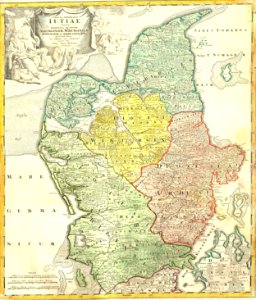
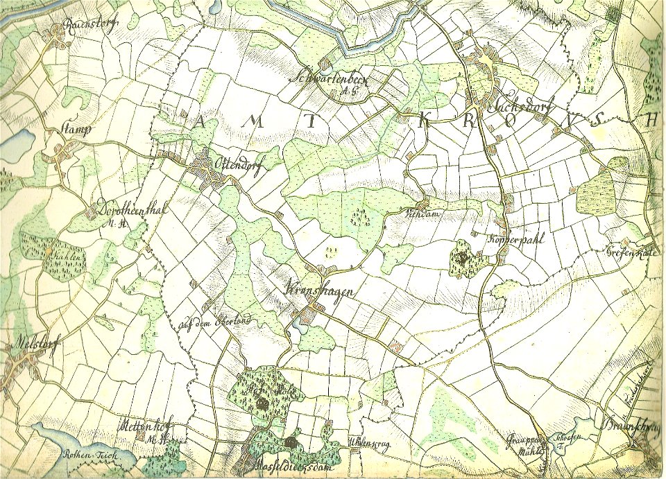
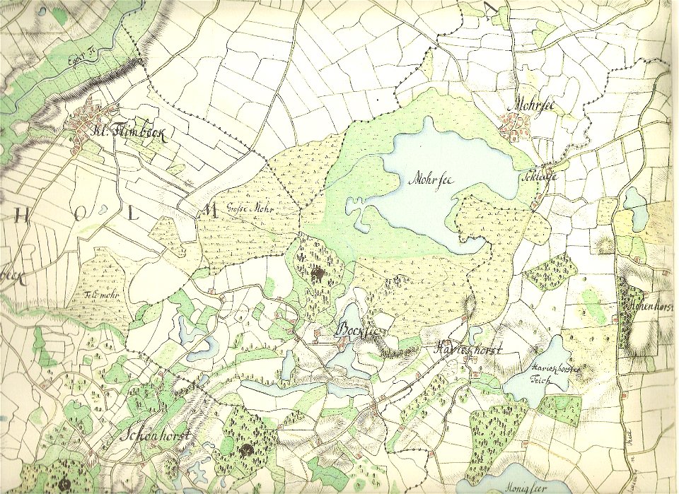
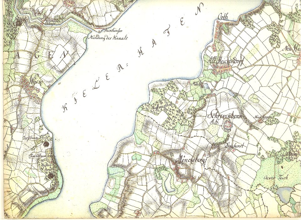
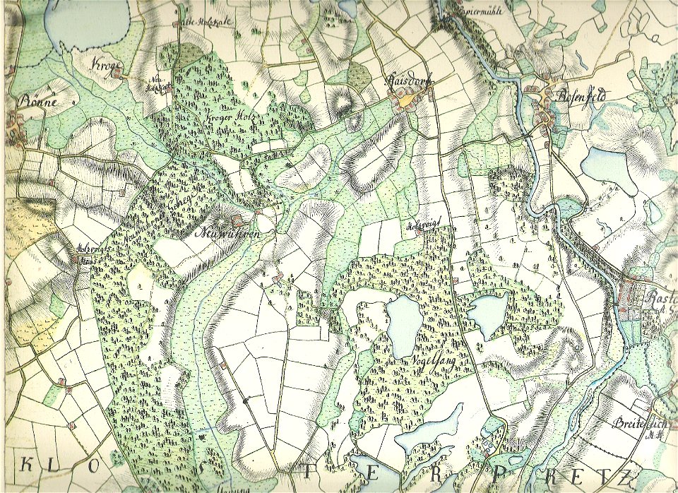
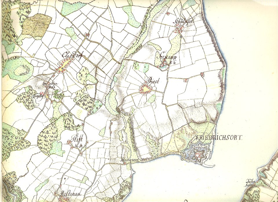
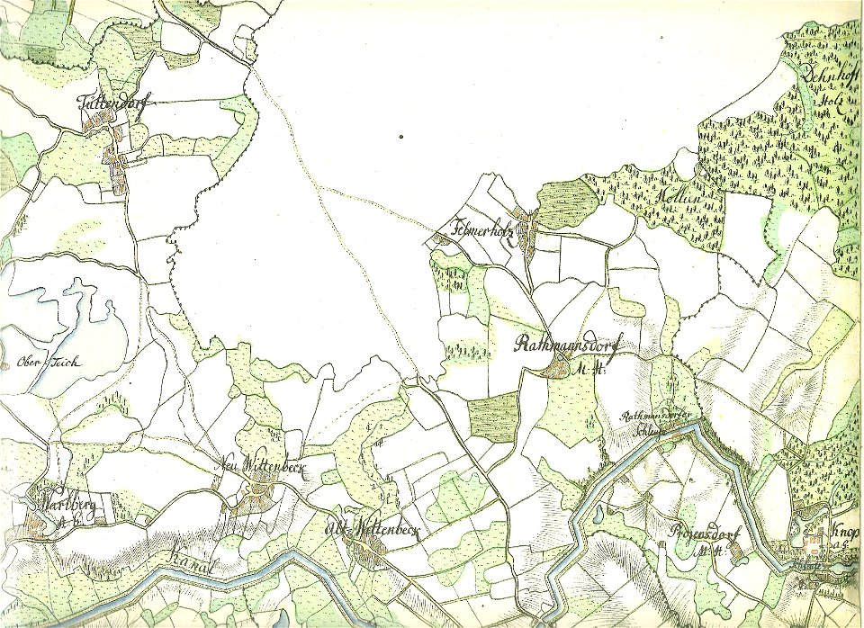
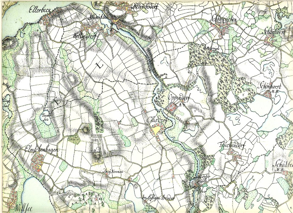
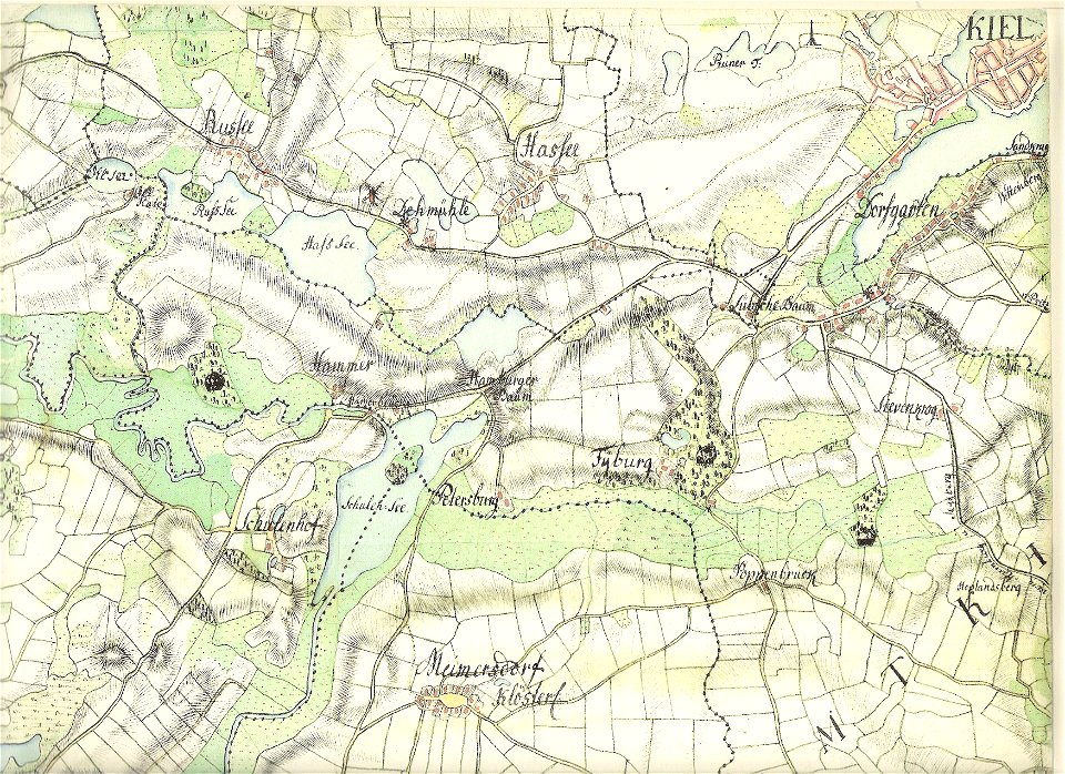
18th-century maps of schleswig-holstein
maps by gustav adolf von varendorf
old maps of kiel
maps by joseph hutchins colton
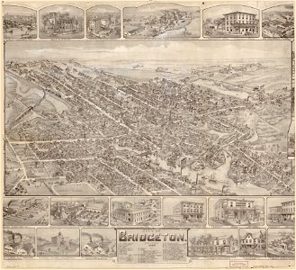
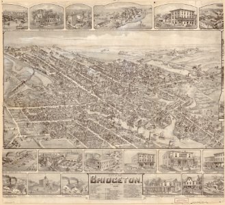
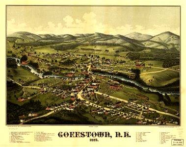
o. h. bailey
1887 maps of new hampshire
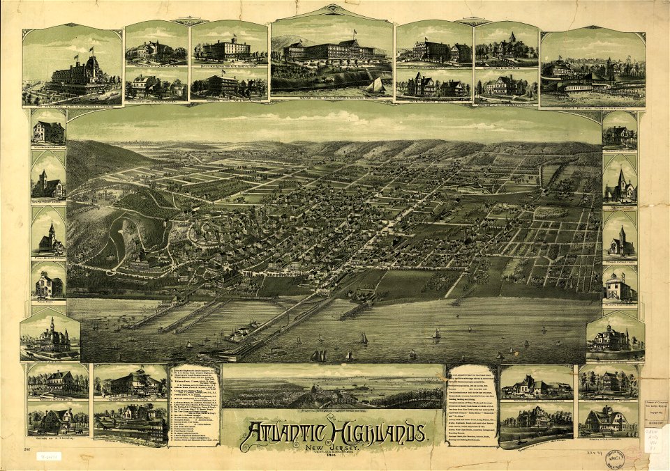
old maps of new jersey
maps by benedetto bordon
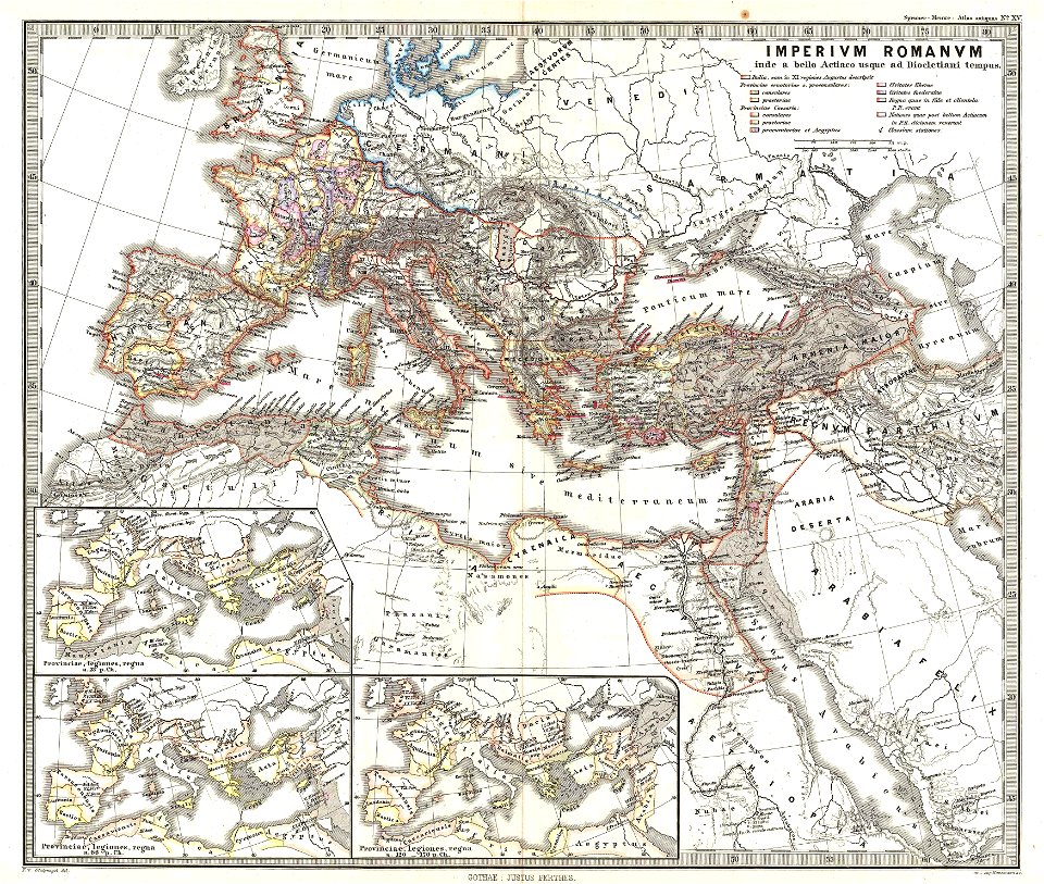
old maps of the roman empire
1865 maps
maps by joseph hutchins colton
1855 maps
maps by joseph hutchins colton
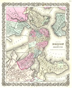
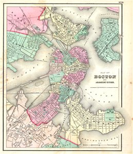
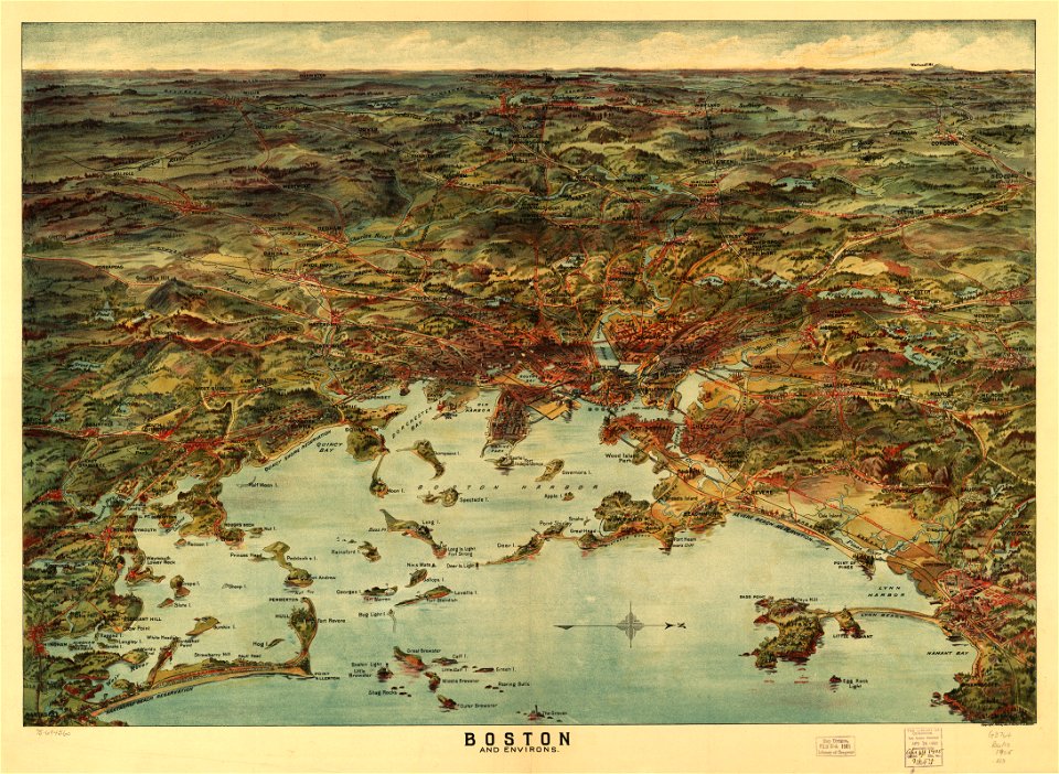
1855 in boston
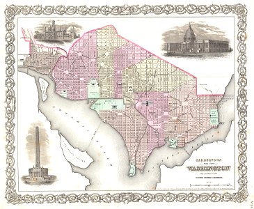
19th-century maps of washington
d.c.,
maps by joseph hutchins colton
1857 in boston
maps from the mechanical curator collection
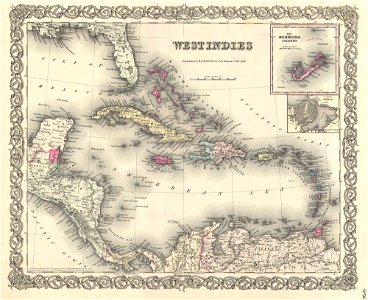
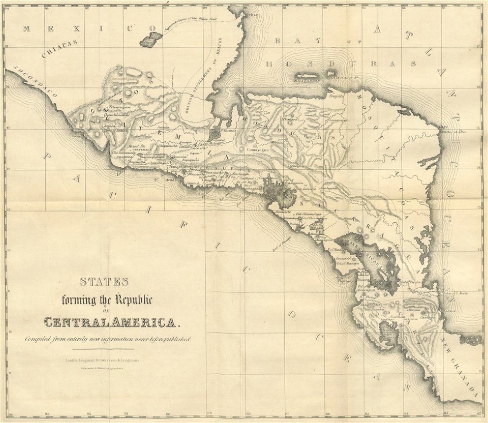
19th-century maps of central america
maps in the library of congress
o. h. bailey
maps in the library of congress
o. h. bailey
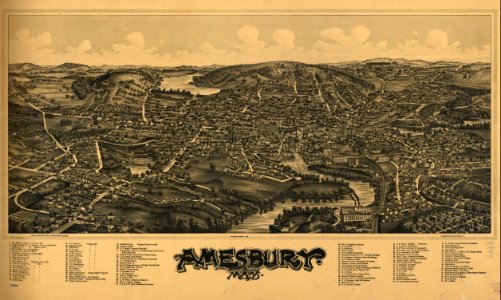
massachusetts
amesbury
massachusetts
amesbury
maps by jacques-nicolas bellin
jacques-nicolas bellin
old maps of the arctic
1747 maps
maps in the library of congress
old maps of new hampshire
maps in the library of congress
old maps of new hampshire
1814 maps
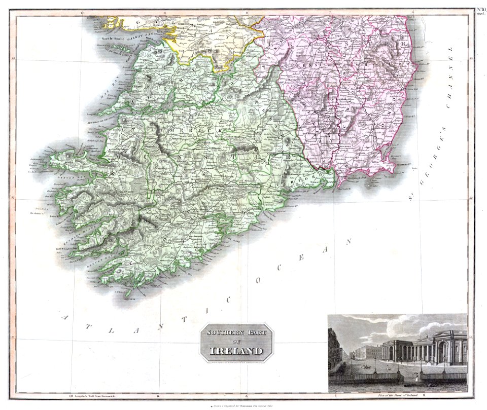
dublin
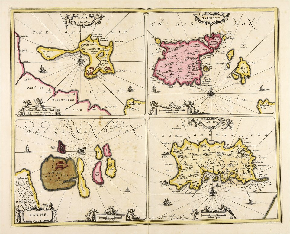
charts and maps of the royal museums greenwich
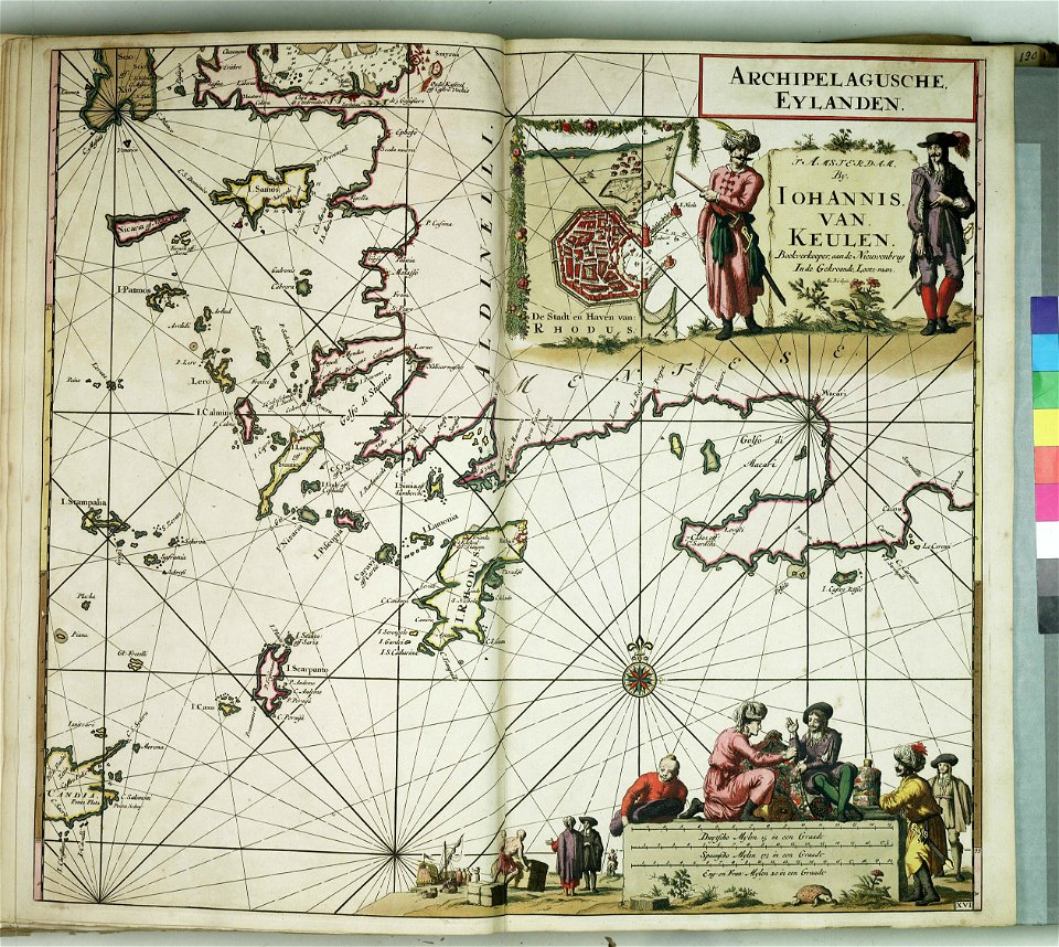
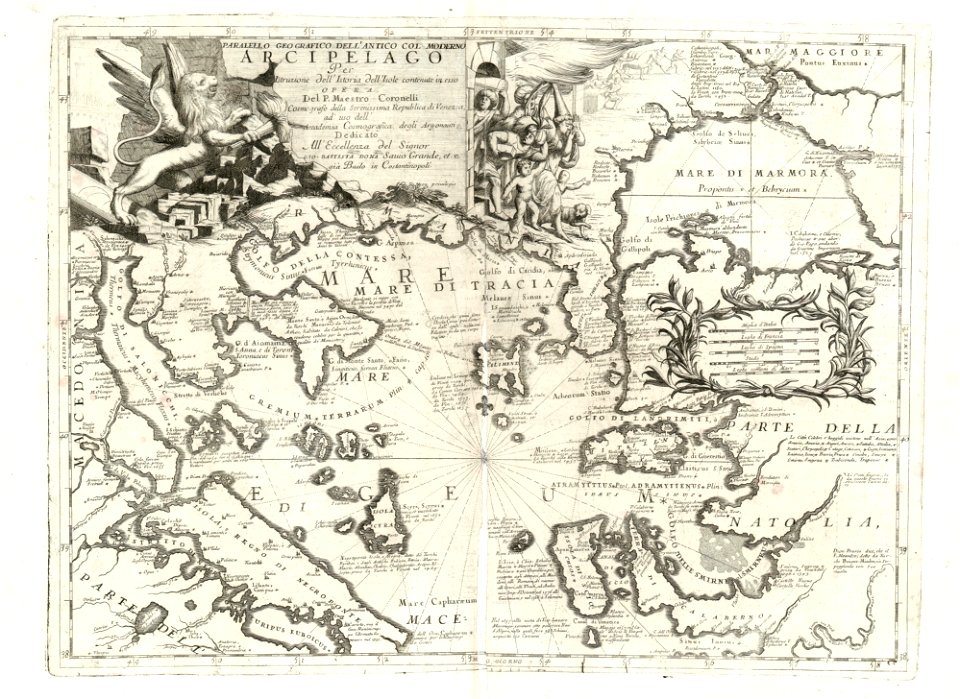
old maps of the aegean sea
charts and maps of the royal museums greenwich
old maps of the aegean sea
o. h. bailey
1894 maps
o. h. bailey
1894 maps
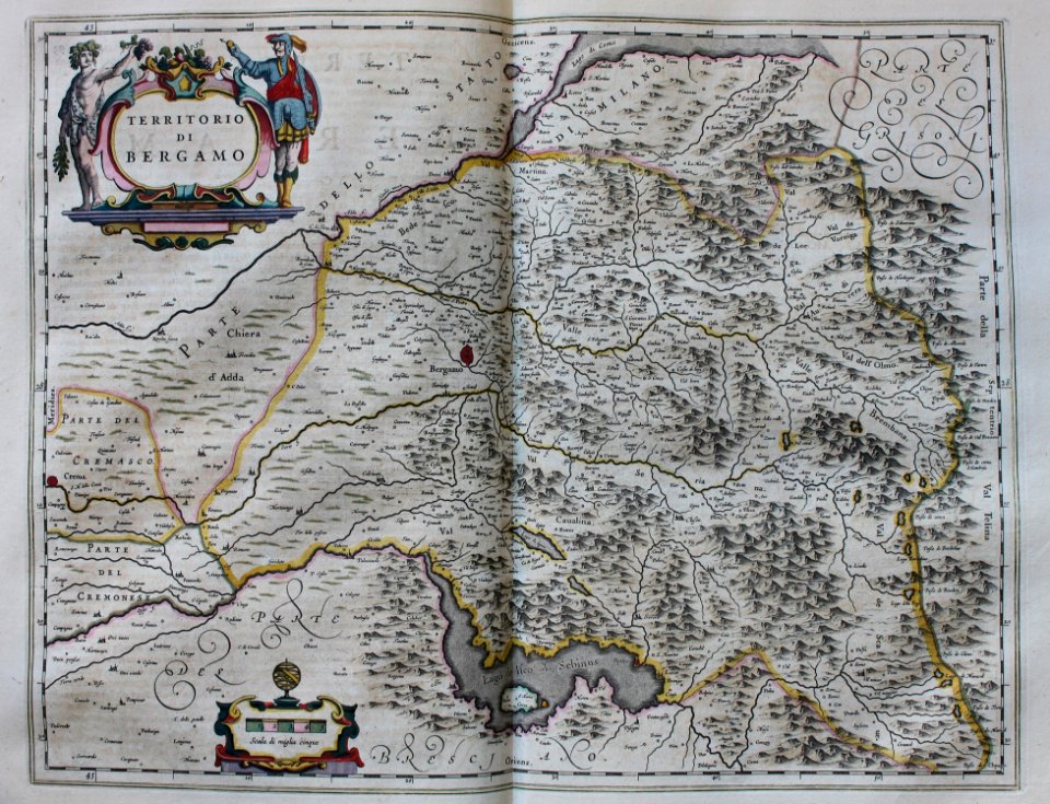
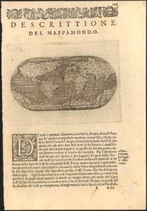
geographia blaviana
1659 maps
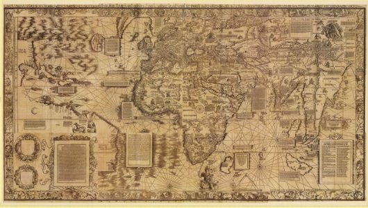
maps by martin waldseemüller
1510s maps of the world
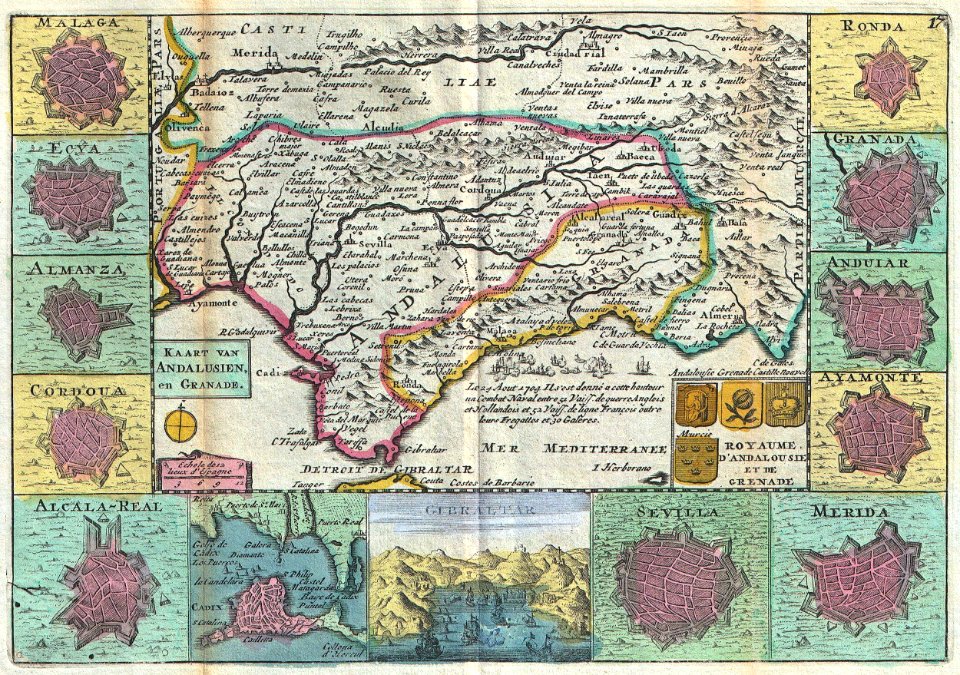
old maps of gibraltar
covens en mortier
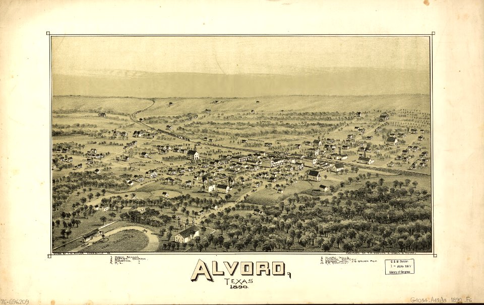
alvord
texas
maps in the national library of australia
1572 maps
maps in the national library of australia
1572 maps
maps with cartouches
braun & hogenberg
johann baptist homann
latin-language maps
johannes ratelband
1747 maps
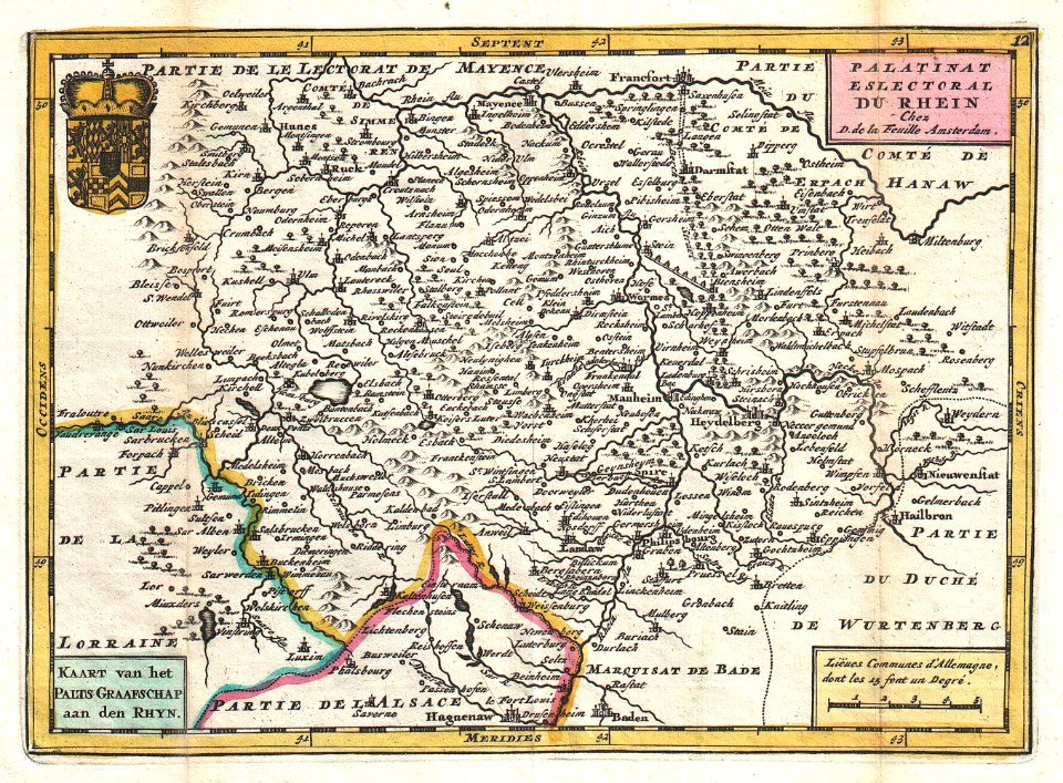
old maps of rhineland-palatinate
johannes ratelband
maps by joseph hutchins colton
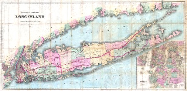
1880 maps of new york (state)
maps in the library of congress
florida
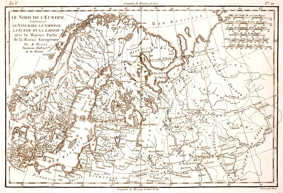
17th-century maps of finland
17th-century maps of estonia
18th-century maps of schleswig-holstein
maps by gustav adolf von varendorf
18th-century maps of schleswig-holstein
maps by gustav adolf von varendorf
18th-century maps of schleswig-holstein
maps by gustav adolf von varendorf
18th-century maps of schleswig-holstein
maps by gustav adolf von varendorf
18th-century maps of schleswig-holstein
maps by gustav adolf von varendorf
18th-century maps of schleswig-holstein
maps by gustav adolf von varendorf
18th-century maps of schleswig-holstein
maps by gustav adolf von varendorf
18th-century maps of slovenia
1758 maps
netherlands
peel
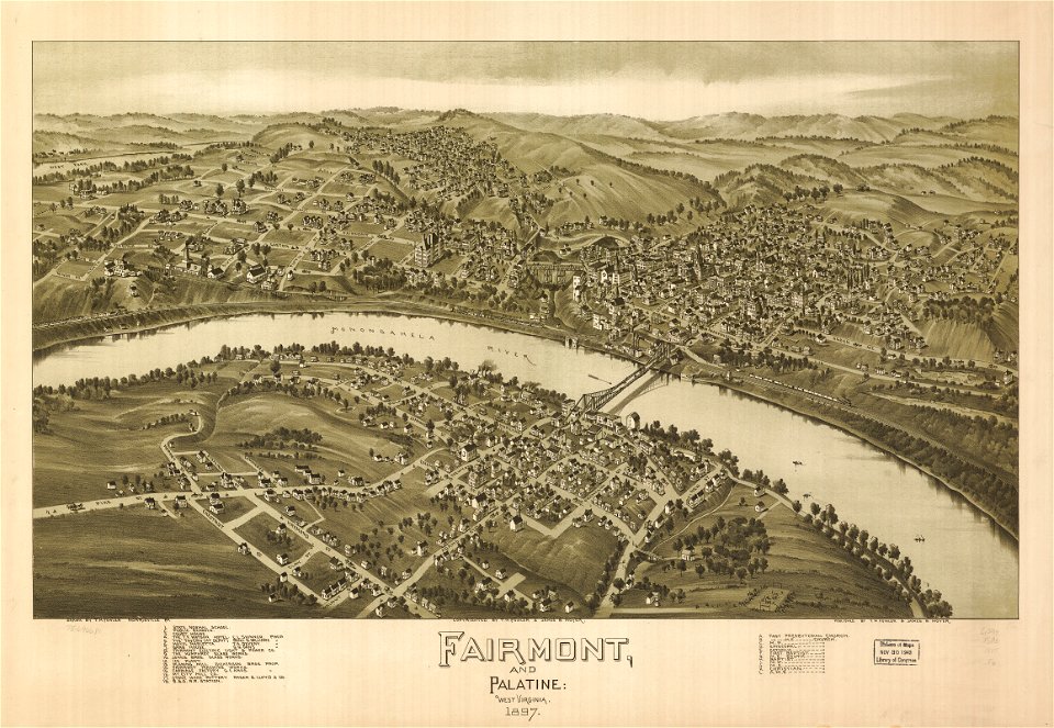
maps in the library of congress
west virginia
maps in the library of congress
west virginia
maps in the library of congress
old maps of new hampshire
estate maps in the national library of wales
estate maps
maps in the library of congress
old maps of new hampshire
johann george schreiber
old maps of saxony
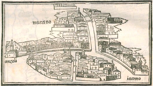
isolario di benedetto bordone (1547)
maps by benedetto bordon
maps by benedetto bordon
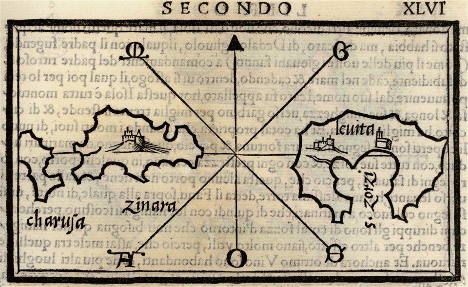
maps of leros
isolario di benedetto bordone (1547)
maps by benedetto bordon
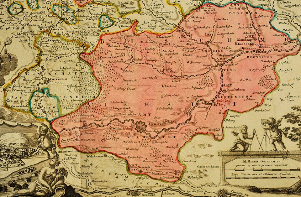
1700s maps of baden-württemberg
bishopric of constance
maps by matthäus seutter
lübeck-altstadt
maps by frederick de wit
copper engraving
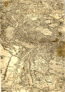
17th-century maps of the black sea
old maps of turkey
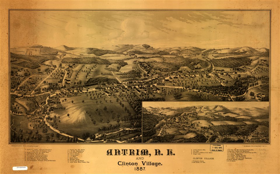
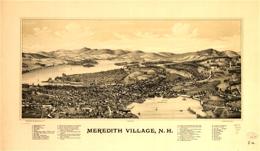
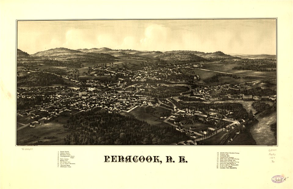
new hampshire
meredith
new hampshire
meredith
maps in the library of congress
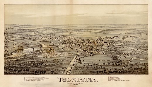
pennsylvania
maps in the library of congress
old maps of pennsylvania
18th-century maps of schleswig-holstein
maps by gustav adolf von varendorf
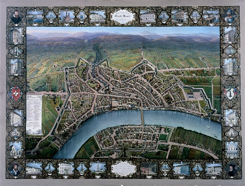
historisches museum basel
maps of basel
johann baptist homann
1717 maps
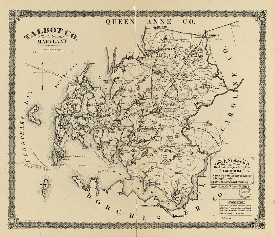
maps in the library of congress
old maps of maryland
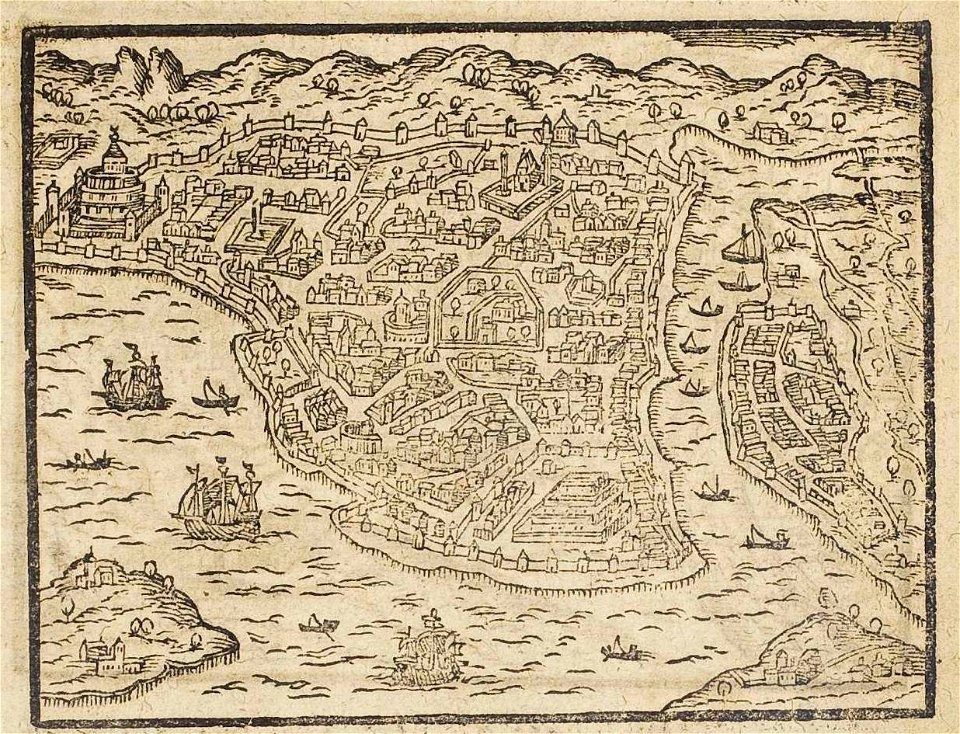
old maps of istanbul
ships on maps
maps in the library of congress
old maps of maryland
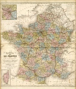
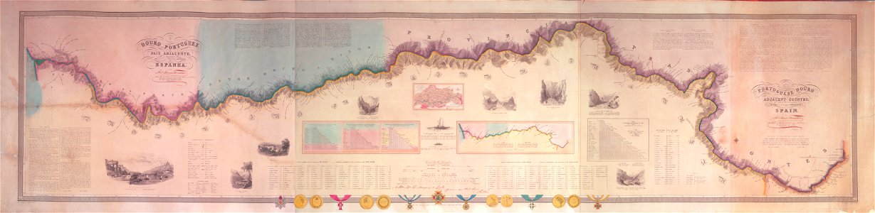
fonds ancely - bibliothèque municipale de toulouse - maps
19th-century maps of france
maps in the library of congress
old maps of new hampshire
maps in the library of congress
old maps of new hampshire
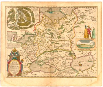
maps of the sea of marmara
vincenzo coronelli
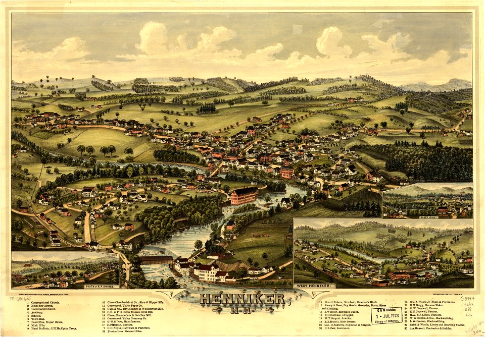
new hampshire
henniker
new hampshire
henniker
maps in the library of congress
o. h. bailey
maps by frederick de wit
vollenhove
maps by benedetto bordon
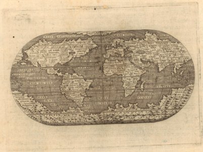
1540s maps of the world
maps in the library of congress
o. h. bailey
17th-century maps of the black sea
old maps of turkey
maps in the library of congress
pennsylvania
old maps of poland
1865 maps
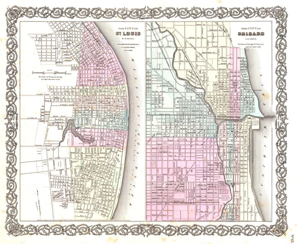
1850s maps of chicago
missouri
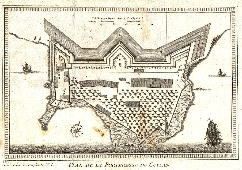
maps by jacques-nicolas bellin
kollam
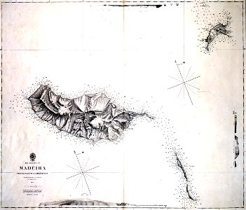
maps in the library of congress
new york
travels in sicily greece and albania
old maps of greece
london
1841
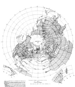
old weather and climate maps
1880 maps
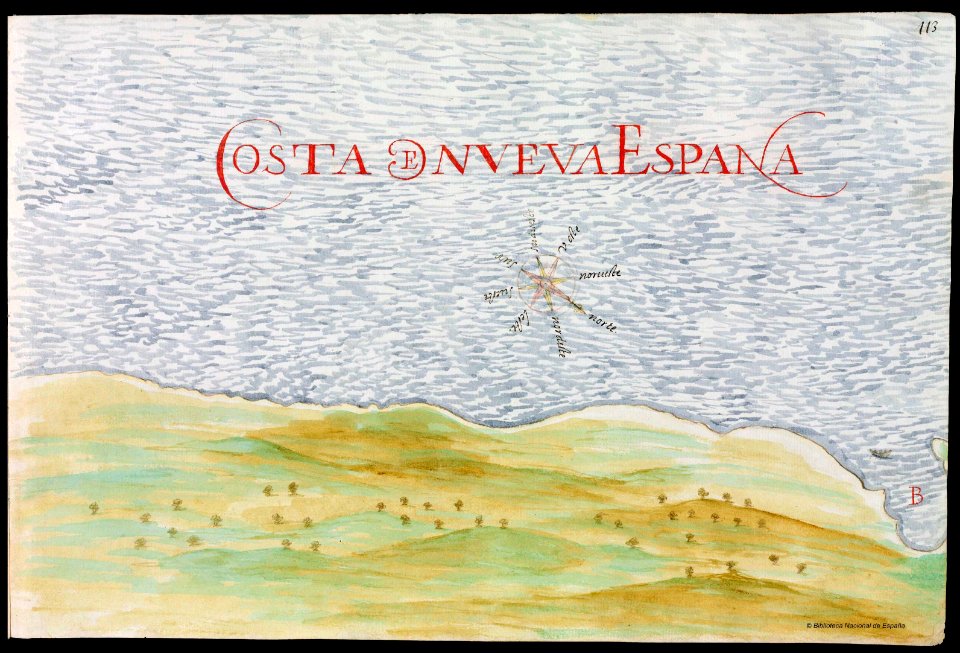
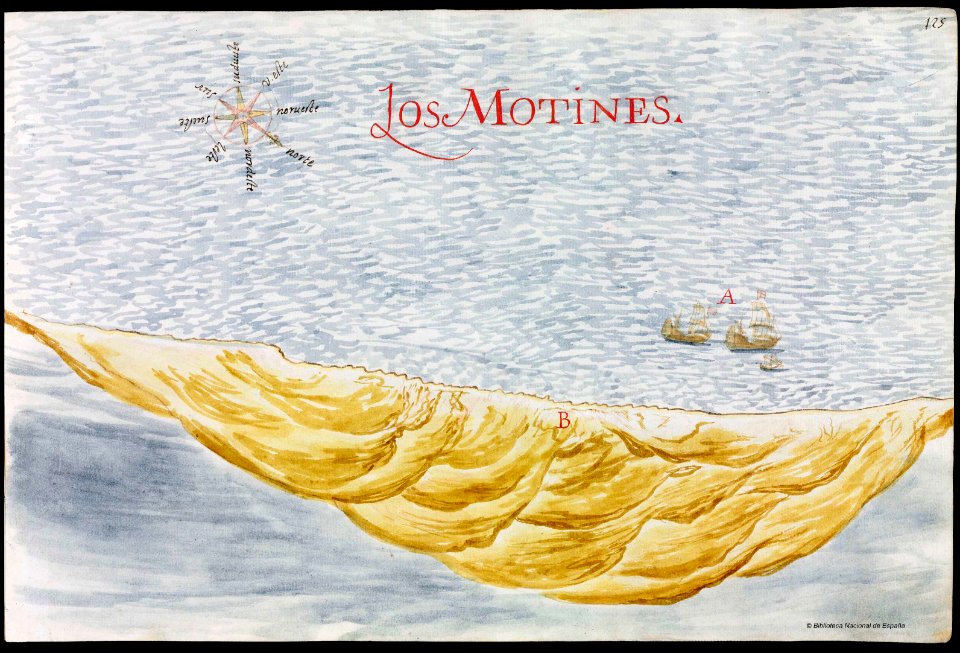
old maps of mexico
pictorial maps
old maps of mexico
pictorial maps
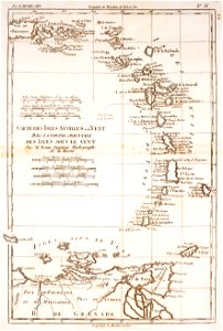
maps of isla margarita
pictorial maps
18th-century maps of north carolina
north carolina
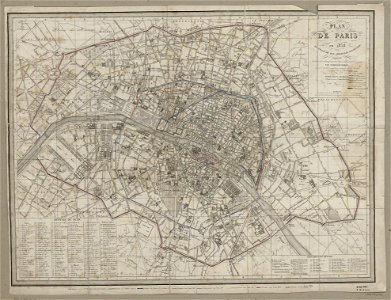
maps of paris from paris musées
1830s maps of paris
old maps of the arabian peninsula
maps of midian
clothing of russia
ships on maps
saint vincent and the grenadines
maps of isla margarita
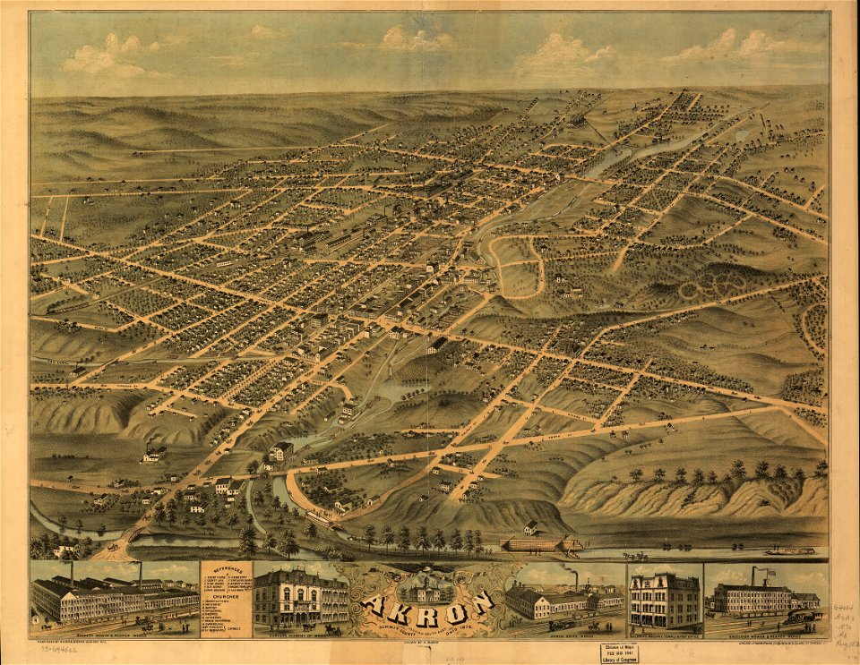
akron
ohio
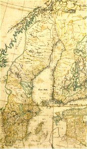
1780 maps of finland
1780 maps of norway
maps made in the 17th century
gerard valck
pictorial history of the russian war 1854-5-6 by george dodd
19th-century maps of the caucasus
facing right and looking at viewer
pilasters in portraits
19th-century maps of africa
maps with figures
joseph james forrester
port wine
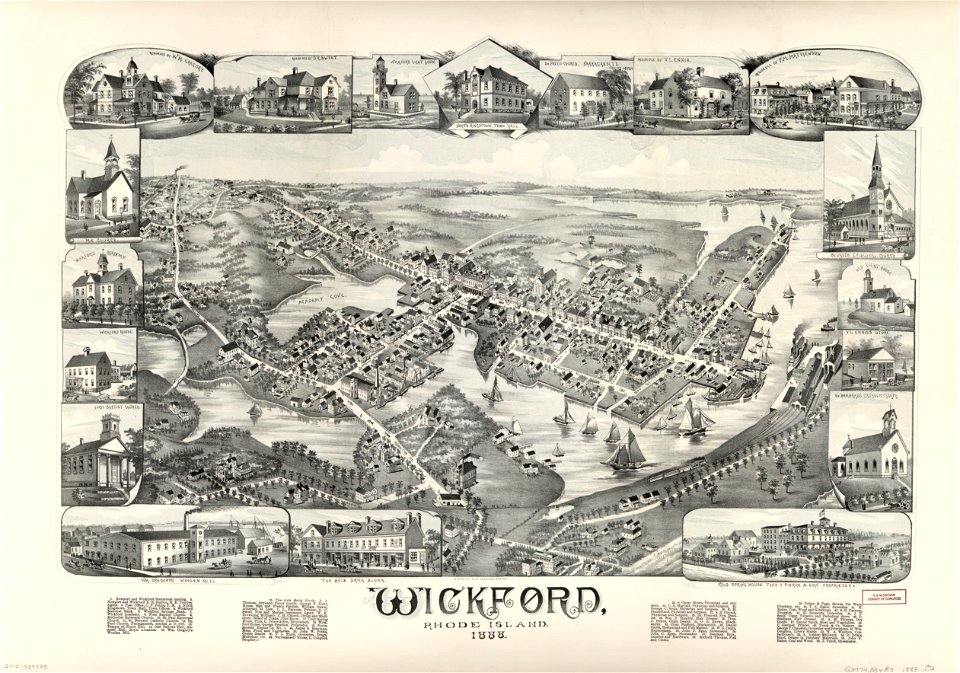
maps by george h. walker and company
maps in the library of congress
maps by george h. walker and company
maps in the library of congress
2501 - 2600 of 33,419
Next page
/ 335